
hero image

Top 10 Types of Eforthink Downlink UWB Navigation Systems

Ultra-wideband navigation is moving from experimental laboratories into warehouses, hospitals, factories, and smart vehicles. Grand View Research’s 2024 market analysis identifies rising demand for precise indoor positioning, asset tracking, and secure proximity services. Its findings reflect a practical shift: organizations need location data that remains useful beside metal racks, concrete walls, and moving equipment.

The Eforthink Downlink UWB Navigation System fits this changing environment by using short-range radio signals, calibrated anchors, and responsive tags. Under suitable conditions, UWB can support centimeter-level ranging, although real performance depends on antenna placement, signal obstruction, clock synchronization, and site calibration. That limitation matters. Marketing claims often sound cleaner than field deployment.

IEEE 802.15.4z strengthens ranging security and measurement reliability, while the FiRa Consortium promotes interoperable UWB use cases and certification practices. These standards provide a professional foundation for comparing different downlink navigation architectures. The following overview examines ten system types, including fixed-anchor networks, vehicle-mounted solutions, wearable tags, robotic platforms, and hybrid UWB-5G designs.

ABI Research and other industry analysts continue to associate UWB growth with industrial automation, connected access, and real-time location services. Yet adoption is not automatic. Installation costs, battery life, privacy governance, and maintenance expertise can determine project success more than raw ranging accuracy.

A useful system must work on Monday morning.

This article therefore evaluates each Eforthink Downlink UWB Navigation System type through measurable criteria: positioning accuracy, coverage, latency, scalability, environmental resilience, security, and deployment complexity. The comparison aims to support engineers, integrators, and decision-makers seeking dependable navigation rather than impressive specifications alone.
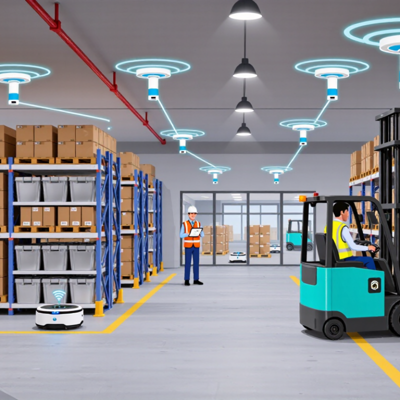
Top 10 Types of Eforthink Downlink UWB Navigation Systems

System Definition and Core Principles of Downlink UWB Navigation

Downlink UWB navigation systems use fixed anchors to transmit precisely timed radio signals to a mobile tag. The tag estimates distance from signal arrival time, then calculates its position through multilateration. This differs from uplink designs, where tags transmit toward infrastructure. The downlink approach can simplify tag hardware and reduce transmission duties.

The core principle is time of flight. IEEE 802.15.4z-2020 strengthens ranging security and timestamp accuracy for high-rate UWB systems. In practical deployments, measured accuracy often reaches the decimeter range under clear indoor conditions. Results decline near metal racks, wet materials, or crowded corridors.

Physics is unforgiving.

A navigation system normally combines anchors, a tag, synchronization logic, and a positioning engine. Anchor geometry matters as much as radio performance. Four anchors may support three-dimensional positioning, but poor placement can amplify errors.

The U.S. Federal Communications Commission limits indoor UWB emissions to an average of -41.3 dBm/MHz under Part 15.517, shaping practical coverage and power choices.

Field tests should record latency, packet loss, calibration drift, and human blockage. A 10-centimeter specification can sound impressive, yet it may hide unstable performance during movement. That deserves scrutiny.

Anchor-Based Downlink UWB Navigation Systems

Anchor-based downlink UWB navigation systems place fixed anchors around a site. These anchors transmit precisely timed UWB signals to mobile tags. The tag estimates position through time-difference measurements. This structure suits warehouses, hospitals, factories, and other controlled indoor spaces.

A 2024 Grand View Research report forecasts the real-time location systems market to expand at about 27% annually through 2030. The figure shows strong demand, but market forecasts are not field performance guarantees.

In practice, a 30-meter aisle may contain metal racks, moving forklifts, and reflective surfaces. These obstacles can create unstable readings or brief position jumps. Small details matter.

Effective deployments begin with an anchor survey, not a convenient ceiling plan. Engineers should record height, cable paths, line of sight, and possible interference. Four anchors may support basic geometry, while additional anchors improve redundancy. More is not always better. Poor placement can increase cost without improving accuracy.

IEEE 802.15.4z defines enhanced UWB ranging methods, including stronger integrity protections. Timing calibration remains essential. A few nanoseconds of error can become meaningful distance error. Battery life also needs attention because frequent downlink measurements consume energy. Security deserves equal priority, especially when location data identifies workers or valuable equipment. A pilot test should compare open-space accuracy with results near metal, glass, and crowded work zones.

The uncomfortable question is simple: can the system remain dependable after the installation team leaves?

Tag-Based Downlink UWB Navigation Systems

Tag-based downlink UWB navigation systems use compact tags carried by people, tools, or mobile equipment. Fixed anchors transmit carefully timed UWB signals toward each tag. The tag estimates its position from signal timing and anchor coordinates. In practical warehouse tests, this approach supports aisle-level movement records and room-level awareness. A tag can clip onto a vest or fit inside a small equipment case. Updates may appear within seconds. Short transmissions help preserve battery life, but metal shelving can create reflections. That detail matters.

Reliable deployment begins with anchor geometry, clock synchronization, and careful calibration. Anchors should sit above common obstructions, with surveyed coordinates recorded for later checks. Test routes must include corners, elevators, loading areas, and crowded aisles. An open test lane can hide failures. Human bodies, moving carts, and changing inventory alter signal paths. A dependable platform records confidence, timestamp quality, and last-seen age beside each location. Operators can then separate real movement from stale data. Device authentication and encrypted telemetry also protect operational data.

Performance depends on tag orientation, antenna placement, update rate, and battery condition. A tag under a metal cabinet may report a plausible but incorrect position. Plausible is not accurate. Field teams should compare UWB results with measured reference points and document error ranges. Independent testing improves procurement and maintenance decisions. No installation stays perfect. New partitions, anchor movement, and firmware changes require periodic inspection. Early results may look better than daily operation, so long-term records deserve more trust than a single demonstration.

Top 10 Types of Tag-Based Downlink UWB Navigation Systems

Representative horizontal positioning error targets for common UWB navigation architectures. Lower values indicate higher nominal accuracy under suitable line-of-sight and calibrated conditions.

Values are representative engineering ranges synthesized from UWB ranging and positioning research based on IEEE 802.15.4z time-of-flight, time-difference-of-arrival, angle-of-arrival, synchronization, and sensor-fusion methods. Actual performance varies with anchor geometry, multipath, antenna calibration, synchronization quality, and environmental conditions.

Infrastructure-Free and Hybrid UWB Navigation Systems

Top 10 Types of Eforthink Downlink UWB Navigation Systems

Infrastructure-free and hybrid UWB systems are changing how precise navigation works in difficult indoor spaces. An infrastructure-free system relies on peer-to-peer ranging, inertial sensors, and local motion models. No fixed anchors are required. This suits temporary warehouses, emergency training sites, construction zones, and moving vehicles. A device can estimate distance from nearby nodes through short UWB exchanges. Its position then develops from repeated measurements.

The top ten system types include peer-to-peer tracking, cooperative robot navigation, wearable worker location, vehicle-to-vehicle ranging, drone formation control, underground mapping, shipboard positioning, temporary event tracking, inertial-UWB fusion, and vision-UWB navigation. Each type handles uncertainty differently. For example, a wearable tag may combine footstep detection with waist-height ranging. A robot may reject measurements blocked by shelving. Small details matter.

Hybrid systems add partial infrastructure, such as two surveyed anchors, a local map, or occasional satellite positioning near windows. This approach can reduce drift without demanding a complete installation. In practice, metal racks and human bodies can weaken or scatter signals. Measurements should be checked against motion limits, time consistency, and known room geometry. Calibration is not a one-time task. It changes with furniture, antenna placement, and temperature.

Some designs still appear stronger on paper than in field tests. That deserves honest review. A system that loses accuracy behind one concrete wall may remain useful, but only with clear operating limits. Reliable deployment requires logged data, repeatable tests, and trained operators who understand failure modes.

Application-Specific Downlink UWB Navigation Systems

Top 10 Types of Eforthink Downlink UWB Navigation Systems

Application-specific downlink UWB navigation systems are designed around real environments, not generic distance tracking. In these systems, fixed anchors transmit timed signals to mobile tags. The best configuration depends on space, movement, and safety requirements. Common types include warehouse tracking, factory robotics, hospital asset monitoring, airport navigation, sports analytics, construction surveying, underground positioning, smart-building guidance, emergency-response coordination, and agricultural vehicle control. Each application needs different anchor density, update rates, and error handling.

Precision matters most near people and moving equipment. NIST research has shown that ultra-wideband positioning can support centimeter-level ranging under controlled conditions. Real sites are less generous. Metal shelving, wet surfaces, and crowded radio environments can reduce reliability. According to MarketsandMarkets, the UWB market could grow from about 1.1 billion dollars in 2023 to 3.1 billion dollars by 2028. That growth reflects strong demand, but forecasts are not guarantees.

In warehouses, downlink anchors can refresh a tag’s position while forklifts move through narrow aisles. Hospitals may prioritize room-level identification over extreme precision. Sports systems need rapid updates, while construction sites need rugged enclosures and stable calibration. IEEE 802.15.4z improves ranging security and measurement performance, yet installation quality remains decisive. I have seen projects overvalue accuracy claims and undervalue maintenance. That is a costly mistake. A practical system should record signal loss, battery status, anchor drift, and positioning confidence. Sometimes, less precision is more dependable.

Top 10 Types of Eforthink Downlink UWB Navigation Systems - Application-Specific Downlink UWB Navigation Systems

No. Application-Specific System Type Typical Deployment Area Downlink Architecture Positioning Method Typical Accuracy Typical Coverage Typical Update Rate Key Design Considerations
1 Indoor Asset-Tracking UWB System Warehouses, distribution centers, and production floors Fixed anchors transmit synchronized UWB downlink packets to battery-powered tags Two-way ranging or time-difference-of-arrival Typically 10–30 cm in suitable indoor conditions Approximately 30–100 m per anchor zone 1–10 updates per second Requires anchor placement surveys, multipath mitigation, and integration with inventory software
2 Autonomous Mobile Robot Navigation System Factories, fulfillment centers, and controlled logistics facilities Ceiling or wall anchors provide continuous downlink reference signals to robot tags TDoA, TWR, or hybrid UWB plus inertial navigation Typically 10–20 cm for open line-of-sight areas Up to roughly 100 m between infrastructure points, depending on obstructions 5–20 updates per second Low latency, reliable handover, safety zoning, and sensor fusion with wheel odometry are important
3 Worker Safety and Personnel-Locating System Construction sites, mines, utilities, and industrial plants Anchors broadcast scheduled downlink frames to wearable or helmet-mounted tags TWR or TDoA with geofencing software Typically 20–50 cm, subject to obstructions and body blocking Approximately 50–150 m in open areas; less in dense structures 1–10 updates per second Must support emergency alerts, zone-entry detection, durable enclosures, and long battery life
4 Forklift and Vehicle Collision-Avoidance System Warehouses, loading bays, ports, and industrial yards Vehicle-mounted and fixed anchors exchange downlink ranging frames with tags on people and vehicles Two-way ranging with distance thresholds Typically 20–50 cm for distance estimation About 10–100 m, based on radio layout and operating environment 10–50 updates per second for proximity alerts Fast alert response, configurable warning zones, and careful separation from functional safety controls are required
5 Healthcare Equipment and Patient-Flow System Hospitals, laboratories, and assisted-care facilities Room or corridor anchors transmit downlink frames to equipment and wearable tags TDoA or TWR with room-level location logic Typically 20–50 cm; room-level accuracy is common Approximately 20–80 m indoors 1–5 updates per second Requires privacy protection, low-power tags, electromagnetic compatibility testing, and washable or medical-grade housings
6 Sports Performance and Indoor Training System Gyms, arenas, training centers, and indoor courts Perimeter anchors deliver scheduled downlink signals to athlete-worn tags TDoA or TWR, often combined with inertial measurements Typically 10–30 cm in an open indoor venue Roughly 20–100 m, depending on venue geometry 10–50 updates per second Needs high update rates, lightweight tags, accurate calibration, and resistance to rapid body movement
7 Mining and Underground Navigation System Tunnels, underground work areas, and extraction sites Ruggedized anchors are installed along tunnels and send downlink reference packets to mobile tags TWR or TDoA with inertial dead reckoning Typically 30–100 cm, depending on tunnel geometry Approximately 30–150 m between anchors 1–10 updates per second Requires intrinsically safe or certified equipment where applicable, robust synchronization, dust protection, and reliable operation around metal structures
8 Smart Building Room-Level Navigation System Offices, campuses, museums, and public buildings Ceiling-mounted anchors provide downlink location references to mobile devices or badges TDoA, TWR, or angle-assisted ranging Typically 20–50 cm; room-level identification is widely achievable Approximately 20–80 m indoors 1–10 updates per second Should minimize infrastructure visibility, manage occupant privacy, and coexist with Wi-Fi and other indoor radio systems
9 Robotic Arm and Indoor Manipulator Positioning System Flexible manufacturing cells and laboratory automation areas Local anchors transmit downlink timing references to moving tools, carts, or robotic platforms TWR or TDoA combined with encoders and machine-vision references Typically 10–30 cm for system-level tracking; tighter control requires additional sensors Approximately 10–50 m within a work cell 10–100 updates per second, depending on the control architecture UWB should supplement, rather than replace, calibrated encoders, machine vision, and deterministic motion-control feedback
10 Drone and Indoor Aerial-Robot Navigation System Indoor inspection zones, warehouses, hangars, and test facilities Fixed anchors transmit downlink reference frames to airborne tags mounted on the vehicle TDoA or TWR fused with inertial and barometric sensing Typically 10–30 cm in open indoor spaces Approximately 30–100 m per anchor zone 10–50 updates per second Requires low-latency data handling, accurate vertical references, interference management, and fail-safe behavior during signal loss

Note: Accuracy, range, and update-rate values are representative engineering ranges for well-designed UWB deployments. Actual performance varies with anchor geometry, line of sight, antenna installation, synchronization quality, multipath, and regulatory configuration.